Pu Ta Leng is located in Tam Duong District, Lai Chau Province. With an elevation of approximately 3,049 meters, it is among the highest peaks in Vietnam and a popular trekking destination thanks to its relatively intact primary forest ecosystem.
 Time:
Time:  Depart:
  Vehicle:
 March is considered a suitable period to climb Pu Ta Leng. The weather is cool and relatively dry, visibility is clearer, and forest trails are less slippery compared to the rainy season. After winter, vegetation begins to grow again and the forest becomes noticeably greener.
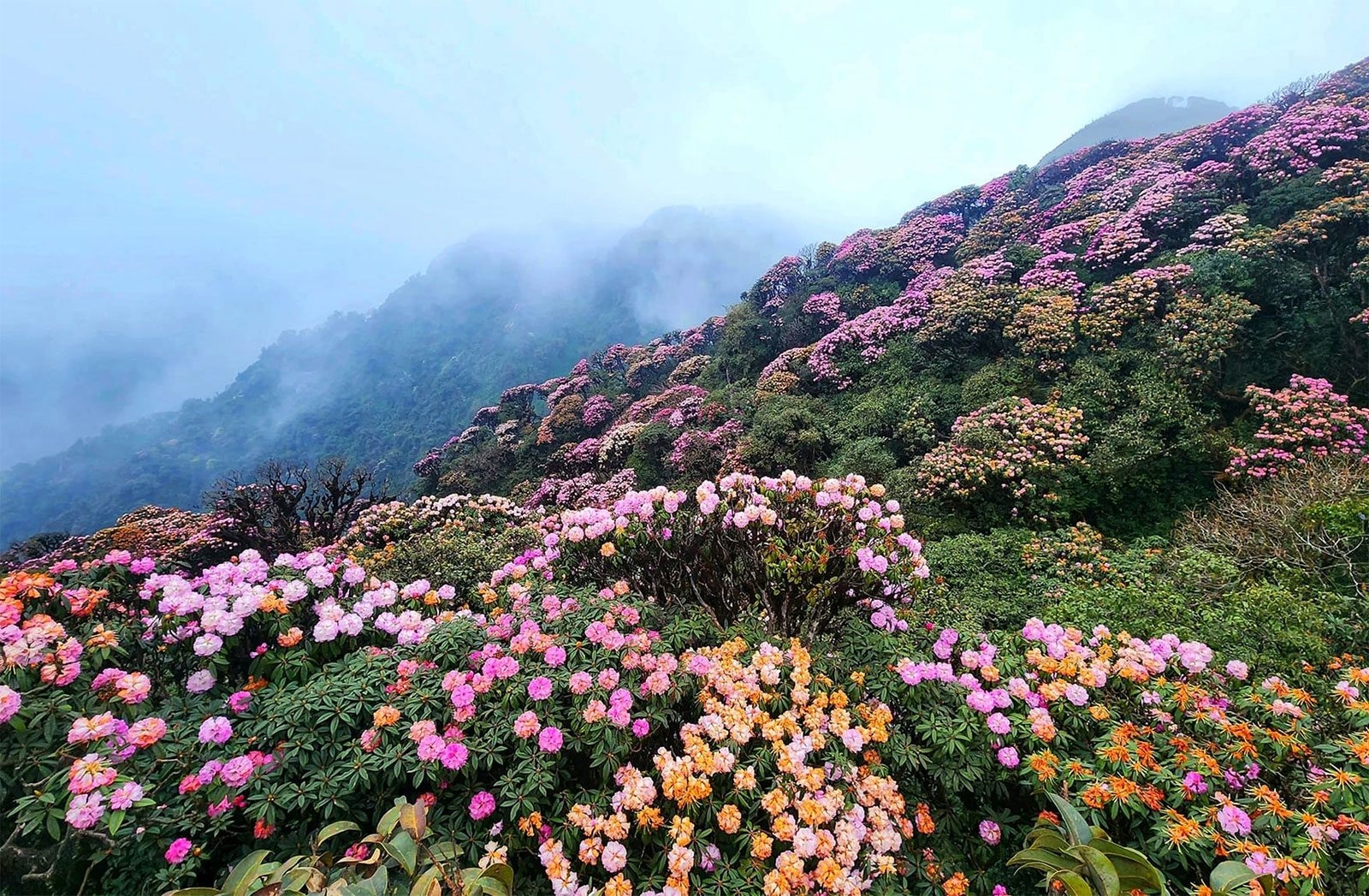
Scenery along the trail

The route passes through dense forest with multiple vegetation layers. During the ascent, trekkers typically encounter:
- Large ancient trees covered in thick moss
- Wooden bridges and narrow forest paths
- Small streams and natural water sources
- Typical mountain forest of the Hoang Lien Son range
At higher elevations, wildflowers begin to bloom, adding color to the green forest landscape.
Campsites and experience

Campsites are located inside the forest on relatively flat ground, usually near water sources. Night temperatures drop significantly, and the air becomes cold and dry. Activities are simple, consisting of basic meals, campfire use, and overnight stays in tents.
Pu Ta Leng is a long trekking route with continuous steep terrain. It is suitable for hikers with good physical condition and prior trekking experience. The route focuses on nature exploration and forest ecology, far removed from urban environments.


Tour information
Pu Ta Leng – One of Vietnam’s Notable Trekking Routes in March


Sign up for consultation
Contact us
PBJP TRADING & TOURISM SERVICES COMPANY LIMITED
- Address:Office 26, 26th Floor, Song Da Building, No. 110 Tran Phu Street, Ha Dong, Hanoi
- Phone : +84 393 250 295
- Website : pbjptravel.com
Connect with PBJP TRAVEL